Welcome to Trail Running Louisville

Here, you'll find detailed descriptions of trails in the Louisville area to help prepare you for your next trail run (or hike)! Please be patient, as this is a work in progress.

Sunday, April 14, 2013

Purple Heart Trail -- Jefferson Memorial Forest


Distance:  2.0 miles


Difficulty:  Strenuous

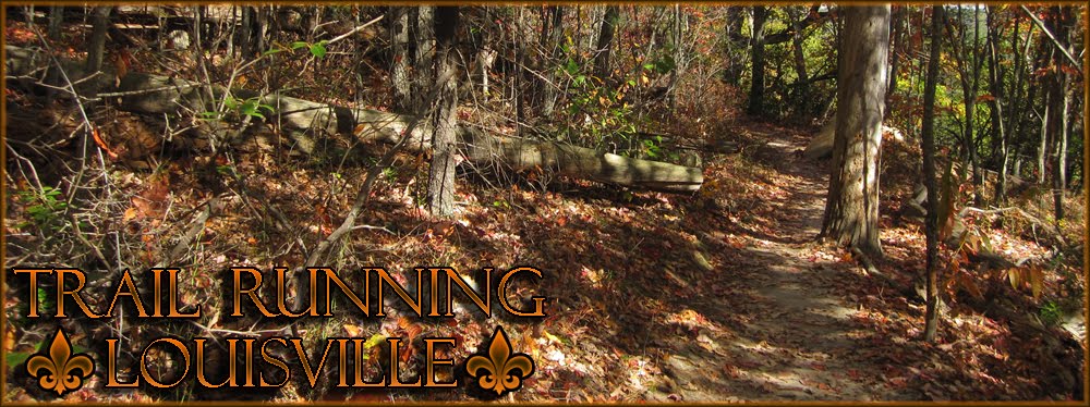
Terrain: Technical--primarily dirt with roots and rocks; creek crossings possible; mostly singletrack

Total Ascent: 1187 feet

Total Descent: 1189 feet

Features:  Ridgetop hiking with scenic views; views of Louisville; seasonal wildflowers; spring and summer offers lots of bird sightings

Trailhead Location: Tom Wallace Recreation Area (Mitchell Hill Road)  Get directions to trailhead

Parking: Paved lot; Get directions to parking lot

Bathrooms: Port-a-pot near lower parking lot (~500' from trailhead); facilities near lake (can not guarantee they are open)

More information:  Visit the Jefferson Memorial Forest website; be advised that this trail is also open for horseback riding (always yield to horses)

After turning from Mitchell Hill Road into the Tom Wallace Recreation Area, travel about one mile to find the trailhead and parking.  The roundabout at the end of the road is the location of the trailhead.  While there are no designated parking spaces in this roundabout, parking shouldn't be a problem.  If you are concerned, just to the left of this roundabout is a designated parking area with a port-a-pot available.


(This trail is what I call a "lasso-loop trail", because it has a straight section that leads to the loop.  This description is based on traveling in a clockwise direction.)


You will enjoy a steady climb from the beginning of the trail, which is packed dirt with an abundance of roots and rocks.  About 500 feet from the start, the trail flattens for just a moment before climbing steeply.  Be sure to look to your right, as you will see your first overhead view of Tom Wallace Lake.

At 0.2 mile, you will reach the top of the first hill, which provides a first look at the awesome panoramic views this trail offers.  Here, you will notice a trail sign indicating the existence of a spur trail to the right.  This spur trail will take you east to the lake and will add less than one mile to your run (round-trip).

Continuing along the Purple Heart Trail, you are greeted with a short, flat section before climbing again on very rocky terrain.  At .35 mile, you will reach a high, flat section with stunning panoramic views that include the Louisville International Airport (NE).  This is a great place to catch your breath or have a quick snack if you've been running for awhile.  Pause to appreciate not only the views, but also to enjoy the beautiful sound of the birds chirping.

If what goes up must go down, here is where you can begin a slow descent.  Just beyond 0.6 mile, you will arrive at sign T3, and a very short spur trail that runs southwest to intersect the Siltstone Trail.  (The intersection of this spur trail and the Siltstone Trail is just over one mile west of the beginning of the Siltstone Trail, at the Welcome Center.)  To continue along the Purple Heart Trail, you will travel right and begin heading north.  This area can be a little wet and muddy at times.

At 0.75 mile, you will be at the highest elevation along the Purple Heart (850').  Running the ridge here is more enjoyable because it is less strenuous and you'll have more great views of the airport to distract you.  After about one-tenth of a mile, you'll take a left around the bend and begin a general descent for the next half-mile or so.  Few obstacles present themselves here, though you will still need to be focused and watch your step.  


At 1.1 miles, the descent becomes steeper with more turns and very uneven terrain--be advised that you might be more comfortable hiking this portion if you are not an experienced trail runner.  It can also be very slippery when wet.

Upon descending this ridge, you'll reach flatter terrain and will run almost parallel to the ridge for a short time.  At this point, you'll face four possible creek crossings until 1.5 miles.  If there has been any recent precipitation, you may find it difficult to avoid getting wet when crossing these areas.  In fact, because this is a lower elevation area, the ground in general may be a little wet in some seasons.

At 1.5 miles, you'll be heading east and will have a brief but intense climb for about one-tenth of a mile.  At 1.75 miles, sign T6 indicates a spur trail to the left (which is the same short spur trail leading to Tom Wallace Lake as mentioned before); turn right to continue along the Purple Heart Trail.  Eventually, you will see Tom Wallace Lake, now to your left.  At 1.8 miles, you'll reach yet another trail sign (T2).  You can turn right to re-do the loop, or turn left return to the parking area and Tom Wallace Lake.  Enjoy the fruits of your labor on this descent, but watch your footing.  It is much more tricky going down than it was going up.


This is a beautiful, but technical trail.  Even when it's not wet, the dirt and rocks can be a little loose.  Take careful, deliberate steps and always survey the ground several feet in front of you as you run.  

Run strong, be smart, find peace!

Sunday, March 24, 2013

Red Trail -- Jefferson Memorial Forest


Spring's daffodils along the Red Trail
Distance: 4.7 miles

Difficulty: Moderate with strenuous sections

Terrain: Varied--including dirt, pine needles, leaves, rocks, roots; creek crossings possible; singletrack and wider

Total Ascent: 1293 feet

Total Descent: 1315 feet

Features:  Exposures, wildlife, footbridge

Trailhead Location: Horine Reservation (Holsclaw Hill Road, Louisille, KY)  Get directions to trailhead

Parking: Gravel lot; Get directions to parking lot

Bathrooms: Pit toilets at trailhead

More information:  Visit the Jefferson Memorial Forest website.

Follow the gravel path from the parking lot to the trail area. You will see the pit bathrooms near the trailhead. There are multiple trails in the area, all of which are well-marked. The Red Trail is identified by the color red.   Follow the directions for the "loop."  Disregard directions for the "shortcut loop."

Trailhead sign for the Red Trail

For the first mile, you'll find yourself traveling over relatively easy terrain, mostly dirt trail. Running parallel to Cemetary Road, a gravel road that leads to forest camping sites, you'll likely see some campers, tents, or at least a few cars if you're here on the weekend.

At mile 1, you not only leave Jefferson County and enter Bullitt County, but you'll also find yourself running through a pine forest. The cushion of the pine needles and the beautiful surroundings make this a favorite portion of the trail. This area tends to be a little more secluded and peaceful, with the exception of an occasional airplane passing overhead.

Approaching mile 2 and the southern portion of the trail, prepare for a steep downhill portion for about a quarter-mile. If you are not an experienced trail runner, you may want to hike this portion until you feel comfortable with descents. As you travel along the exposure, you will notice the creek below. Continue beyond the switchback and you will find yourself running along the creek, and then crossing it. After periods of rain or snow, expect a little (or a lot) of water.

Creek crossing along the Red Trail
Immediately after crossing the creek, you'll be faced with a nice series of climbs. Be prepared to be tested here--even some of the most seasoned trail runners have to walk these hills. The trail becomes rocky but totally navigable, and just after reaching mile 3, you'll make a left turn and begin heading northward. Here, you will be treated to some fast downhill sections, which do not last long enough (less than a half-mile).

Footbridge on the Red Trail


After crossing the footbridge, you must endure a killer 0.15 mile hill (gain of about 240’) that makes both your calves and your lungs burn! At the top, the red trail junctions with the orange trail. Take a left to head back to the parking lot where you began this journey.


Not far beyond the 4 mile mark, you'll find more pine trees and some very gentle hills to traverse. Around 4.5 miles, you will see a fence ahead, signaling the near-end for your trail run along the Red Trail. Go around the fence and follow the trail a few more feet. You will cross Cemetary Road and return on the portion of the trail on which you started.


Run strong, be smart, find peace!

Saturday, March 23, 2013

Becoming a Beginner Again: Tips for Safe and Fun Trail Running

Running and hiking have been passions of mine for a very long time, and trail running is the perfect marriage of the two. If you are a runner who enjoys hiking, the transition into trail running will be easier than if you’ve never hiked. Hikers understand the differences in terrain and navigation and in some cases, weather fluctuations. If you are strictly a road runner, you may find that the following tips will have you better prepared for your first steps off of the concrete and onto the dirt, mud, gravel, bark or grass.

LOCATION
Since this is your first trail run, look for short, non-technical (smooth, flat) trails. Avoid big elevation changes and extremely rocky or rooted trails for now—your lungs and legs might not be ready for such a challenge. If possible, find an easy trail that is 1-2 miles in length (or even a grassy area) and become one with that trail.Notice how different the surface feels. Pay attention to your surroundings and really enjoy the environment.Starting on a short trail will help you make an informed decision about whether or not you ever run trails again.

GEAR
Make the same apparel choices that you would make for a typical run. Wearing weather-appropriate, breathable clothing that does not restrict movement is the smart choice. As you become more comfortable with trails in general or trails in a specific area, you may find that you will have to make adjustments to your clothing choices. But for now, stick with what you know.

Perhaps most importantly, you will need a good pair of shoes. If this is your first attempt at running trails, it is not necessary to purchase a new pair of trail runners. I think it is important, however, that you wear a sturdy pair of running shoes (that can get dirty!) with good tread. When and if you decide that trail running suits you and that it is something you plan to continue, trail shoes are a wise investment—if not a necessity. In general, trail running shoes are different from road running shoes in that they are made to provide more protection for your foot and better grip for the non-smooth surfaces. If you decide to invest in a pair, look for shoes that are similar to your road running shoes (support shoes if you are a pronator, for example). Also, consider what terrain you will be running. If you expect to run trails that are extremely rocky, you will need a shoe that has tread with more lugs, or less open space.

EASY DOES IT
Remember when you first started running and everyone kept telling you to “start slow?” You are going to have to do that again. Forget any time and performance expectations for now—running trails will almost certainly add seconds—even minutes—to your pace per mile. Because of the surface and possible elevation changes, covering a single mile will not only take longer, but it will probably feel MUCH more difficult. Go slow and take it easy. After all, trail running, even though it seems hardcore, is naturally more laid back.

PAY ATTENTION
It is very important to be aware and observant while running roads—after all, there are speeding cars, cyclists late for work, kids running after kick balls, and unleashed, rabid dogs. However, it’s even more important to be aware of your surroundings while running trails. While the obstacles won’t be as big as the ones out in the city (unless you intend to go head to head with a Grizzly), there are far more of them in a smaller area. A single rock can put an end to your trail run in an instant. So pay attention to where you are stepping. Try to scan the area several feet in front of you as you run, while still appreciating the beautiful scenery that surrounds you. And use the environment to your advantage. For example, use embedded tree roots upon a steep hill as a natural staircase to keep you from sliding on slick dirt.

Also, while it’s VERY tempting to hurdle yourself over tree trunks or streams, do NOT do this. Your legs might be more tired than you realize and you could easily take a hard fall by not clearing the obstacle. My advice to beginners is to WALK when you reach these types of obstacles. Once you are more familiar with the trail and more comfortable with your performance, you may be able to blaze through and really have fun speeding over tree trunks—but for now, play it smart.

Pay attention to your running form, as well. Fatigue will set in much earlier on trails but you still need the clarity of mind to focus on pumping your elbows and lifting your legs. If you do not, you will almost certainly trip if you are lucky and fall if you are not.

BE SAFE
I advise anyone--especially while running-- to be aware of their surroundings and to be prepared for anything, but in some ways, the primal nature (and mystery, to some) of trail running makes this advice even more important to heed. Sure, watch out for unsavory people, but be cautious about wildlife, getting lost, dehydration and/or getting injured. Your first move should be to let someone know where you will be and the duration of your run. Tell a friend or family member, or the ranger at the visitor center.

Some runners prefer to carry absolutely nothing and for those folks, I suggest that you at least carry your cell phone. Just be aware that you might not have a signal in some areas. For the runners that carry everything, just bring a few essentials. If you are the type of person that gets lost easily (or even if you do not) bring a map of the trail. Depending on the weather, the length of your run and your hydration/energy needs, you may consider bringing water and a small snack. You never know when your 30 minute trail run will turn into a 2 hour adventure! And if you’re injury-prone, you might want to bring a small first aid kit for your car.

Watch out for poison ivy or other plants that could cause skin irritation. Try to avoid overgrown trails if possible. Also, insect repellent is a must, especially in the summer.

BE CORNY
It is totally acceptable to pretend that you are an early human running through the wilderness after your family’s dinner, a wild boar. You could also pretend that you are living right inside of a Bob Ross painting.Or perhaps you would rather imagine you are the focal point of one of the “Rave Run” photographs from Runners World. Just have fun.

(Excerpted from an original article from my general running blog: Case of the Runs: A Blog by an Amateur Runner with an Olympian-Sized Heart, posted on October 5, 2011)

Friday, March 22, 2013

Your Guide to Understanding Trail Descriptions

The introduction of each trail description includes the same basic information: distance, difficulty, terrain, total ascent and decent, features, location of trailhead, parking, and bathroom availability.  Because every park and every trail is different, this information is provided to help you make decisions to best prepare you for your adventure.

Below, I have provided an explanation for each category to help clarify any inconsistencies you may notice with park documentation or even due to equipment differences.  The information provided here is accurate and up to date, to the best of my ability and knowledge.  If you have a question about anything, please refer to the particular park's website or visitor's center, or contact me.  

Distance:  Determined using Garmin Forerunner 305.  It is possible that this information will not match "official" distance information from park documentation (when available).  However, when possible, the distance information you find reported here will be the "average" distance determined after multiple visits using the Garmin Forerunner 305.  In general, the reporting differences will be somewhat negligible where running is concerned--typically not more than two tenths of a mile.

Difficulty:  Difficulty is a relative term.  In general, you'll find that park documentation (when available) tends to overestimate the difficulty of a trail.   The assumption of Trail Running Louisville is that you are a hiker or a runner with moderate fitness and ability; therefore, the difficulty rating here is geared toward active people in good health and with a moderate fitness level.  All of the attributes of the trail are considered when rating a trail's difficulty, including amount and type of hills, terrain, distance, exposure, and elevation.

Obviously, some people will find some trails more difficult, and others may find some less so.  When in doubt, read through the full trail description and check official park documentation (when available) to make your own decision.  

Terrain:  Trails can consist of one or more of the following: grass, dirt, gravel, wood chips, rocks, roots, bodies of water.  They may be flat or uneven.  In general, trails composed of rocks and roots tend to be more technical (and uneven) than trails lacking them.  

Total Ascent:  Determined using Garmin Forerunner 305

Total Descent:  Determined using Garmin Forerunner 305

Features:  Some highlights to watch for along the trail, including things like footbridges, special plants, historical sites, or wildlife.

Trailhead Location:  General location information and link to trailhead location on Google Maps.

Parking:  Type of parking lot (gravel, paved, dirt, grass), and any fee (if applicable); plus the link to the parking lot location on Google Maps.

Bathrooms:  Type of bathroom facilities, if available

More information:  Information about any special requirements, such as fees or permits; safety precautions such as warnings about poison ivy, insects, wildlife, or special environmental considerations